
Related Products
AGV Navigation System: 7 Navigation Technologies Commonly Used in Modern AGVs
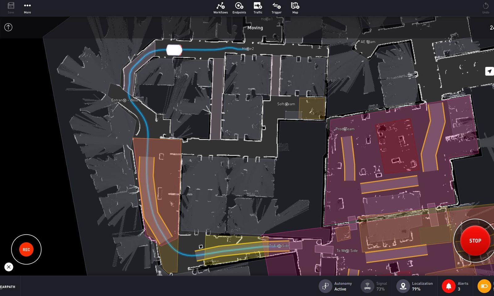
Compare seven AGV navigation technologies, including LiDAR SLAM, QR codes and laser reflectors, by flexibility, infrastructure, maintenance and applications.
Compare seven AGV navigation technologies, including LiDAR SLAM, QR codes and laser reflectors, by flexibility, infra...
An AGV navigation system determines how a vehicle identifies its position, follows a planned route, and arrives accurately at pickup, drop-off, or equipment-interface points.
Early AGVs relied heavily on fixed-path methods such as embedded wires and magnetic tape. As sensors, positioning algorithms, and onboard computing have advanced, modern AGVs can now use technologies such as QR codes, laser reflectors, LiDAR SLAM, and visual navigation. As a result, the idea that "AGVs must follow fixed tracks" no longer fully describes modern AGV systems.
The differences between these navigation methods go beyond positioning principles. They also affect facility modifications, route flexibility, maintenance requirements, and future expansion. The following sections explain seven navigation technologies commonly used in AGV projects.
LiDAR SLAM / Natural Navigation
LiDAR SLAM, also commonly referred to as natural navigation, is one of the most important navigation technologies used in modern AGVs.
LiDAR continuously scans the surrounding environment and captures the contours of fixed structures such as walls, columns, racks, and machines. The vehicle compares these real-time scans with a previously created map to calculate its current position and orientation.
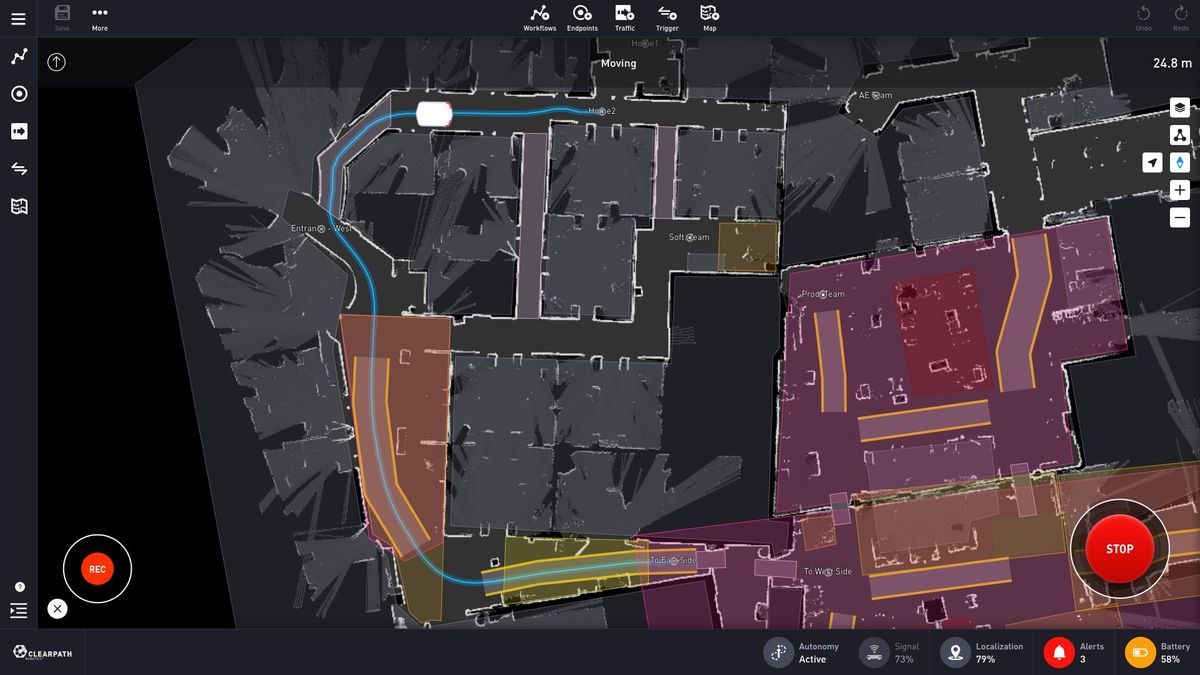
Because positioning relies on existing environmental features, the operating area usually does not require continuous magnetic tape or large numbers of physical markers along the route. When routes or stations change, many adjustments can be made in the map and software without modifying the floor.
This makes LiDAR SLAM well suited to factories and warehouses with multiple routes or layouts that may change over time. It is therefore increasingly used on autonomous forklifts, lifting AGVs, and heavy-duty mobile robots.
Natural navigation still depends on the quality of environmental features. Large areas with repetitive structures, too few distinct contours, or frequent major changes to equipment and rack layouts can make localization more difficult. In practice, wheel encoders, IMUs, and other motion data are often fused with LiDAR to improve positioning stability while the vehicle is moving.
QR Code Navigation
QR code navigation uses QR codes placed on the floor as position references for the AGV.
When a downward-facing camera passes over a QR code, it reads the encoded position and orientation information and uses those known coordinates to correct positioning errors accumulated during motion.
Because QR codes can be arranged systematically near aisles, intersections, rack locations, and workstations, this method is particularly suitable for warehouses with dense nodes and clearly structured routes. It is commonly used by warehouse robots, under-ride AGVs, and lifting AGVs.
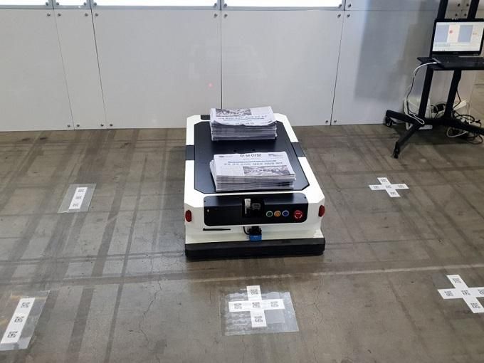
For example, an AGV can travel between two QR codes using wheel encoders and vehicle control, then recalibrate its position when it reaches the next code. This avoids the need for a continuous physical guide path while still providing clear reference points at critical locations.
This discrete-marker approach also makes it relatively easy to add navigation nodes. However, QR codes are exposed directly to the operating environment. Dust, oil, scratches, and repeated vehicle traffic can reduce camera readability, so floor condition and marker maintenance have a direct impact on system performance.
Laser Reflector Navigation
Laser reflector navigation is a mature technology that has been used in industrial AGVs for many years and is still found in vehicles such as automated forklifts where stable positioning is important.
Reflectors are installed on walls, columns, or other fixed structures. A laser scanner on the AGV detects these reflectors and calculates the vehicle's current coordinates from the geometric relationship between multiple reflectors with known positions.
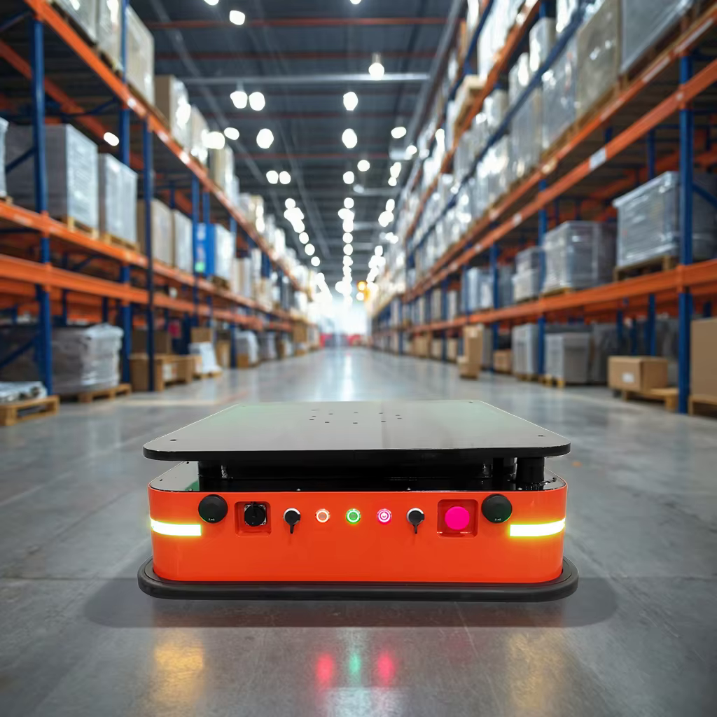
Because the reflectors are fixed and easy for the laser to identify, the vehicle can localize across a large area without following a continuous track on the floor.
This also explains the main difference between laser reflector navigation and LiDAR natural navigation: reflector-based systems rely on deliberately installed positioning targets, while natural navigation uses existing features such as walls, columns, and machine contours.
The reflectors provide stable and clearly defined references, but they also add infrastructure requirements. Their positions must be planned during implementation, and if machines, racks, or the facility layout change substantially, reflector visibility and map configuration may need to be reviewed.
Magnetic Tape Navigation
Magnetic tape navigation uses a relatively straightforward guidance principle.
Magnetic tape is laid on the floor along the planned route. Magnetic sensors under the AGV continuously detect the magnetic field and correct steering according to the vehicle's offset from the tape.
The vehicle does not need to interpret complex environmental features or continuously calculate a free path, which makes magnetic tape practical for fixed and repetitive production logistics.
For example, a factory may run the same loop for years:
Warehouse -> Production Line -> Empty Cart Return -> Warehouse
When a route remains largely unchanged for a long period, magnetic tape can provide stable cyclic transport with relatively simple control logic.
That stability comes from having a clearly defined physical path, but the same path becomes a limitation when the layout changes. Moving a production line, adding stations, or changing an aisle may require the tape to be relaid. In areas with frequent forklift or pedestrian traffic, surface-mounted tape can also wear over time.
Magnetic tape navigation is therefore best suited to logistics routes that remain stable rather than facilities where routes are frequently redesigned.
Visual Navigation / Visual SLAM
Visual navigation uses cameras to observe the surrounding environment and determine vehicle position from visual features such as building structures, machine contours, signs, or other identifiable references.
Visual SLAM goes further by using continuous image sequences to build a map and localize the vehicle at the same time, allowing the AGV to operate without a continuous guide path on the floor.
Cameras can capture rich environmental information. In addition to supporting localization, the same visual system can potentially be combined with object recognition, marker recognition, and other perception functions.
The tradeoff is greater dependence on visual conditions. Sunlight entering the facility, changes in lighting, reflective surfaces, shadows, temporary occlusion, and large low-texture areas can all affect the features available to the camera.
For this reason, visual navigation in industrial AGVs does not always operate as a completely standalone system. It may be fused with LiDAR, IMUs, wheel encoders, or other positioning data to reduce the impact of lighting and environmental changes on camera-only localization.
Magnetic Spot Navigation
Magnetic spot navigation uses magnetic markers like magnetic tape navigation, but it does not require a continuous strip along the floor.
Magnetic spots or markers are embedded at selected points along the route. When the AGV reaches one of these points, magnetic sensors detect the reference while wheel encoders, steering-angle data, and inertial information estimate motion between markers.
As the vehicle travels from one magnetic spot to the next, positioning error can accumulate. When it reaches the next known marker, the system uses that reference to recalibrate the vehicle's coordinates.
Because the magnetic markers are usually embedded in the floor, this approach reduces the wear associated with surface-mounted magnetic tape and can offer good durability in long-term industrial operation.
However, it addresses the wear issue without eliminating the route-flexibility limitations of fixed infrastructure. Adding or changing a route normally requires new or repositioned magnetic markers, so later route changes are less convenient than with LiDAR SLAM, where routes are adjusted primarily in software.
Wire-Guided / Inductive Navigation
Wire-guided navigation is one of the classic navigation methods from the early development of AGVs.
A conductive wire is embedded in the floor and carries a specific electromagnetic signal. Sensors under the AGV detect the field and steer the vehicle according to its offset from the wire, keeping it on the predefined route.
Because the route is clearly defined by the buried wire, the vehicle does not need a complex environmental map or real-time interpretation of surrounding features. The control logic is mature and stable.
The main cost of this fixed-path approach appears during installation and later modification. The floor must be cut, wired, and restored, and if the production layout changes, the route usually requires new construction work.
As LiDAR SLAM, QR code navigation, and other more flexible methods have become common, embedded-wire guidance is no longer the first choice for many new AGV projects. It can still be useful, however, for long-term fixed loops and for existing AGV systems built around this technology.
Comparison of the 7 AGV Navigation Systems
Viewed side by side, the main differences among these seven navigation methods are route flexibility, infrastructure requirements, maintenance approach, and dependence on environmental conditions.
| AGV Navigation System | Main Advantages | Main Disadvantages | Route Flexibility | Infrastructure Required | Typical Applications |
|---|---|---|---|---|---|
| LiDAR SLAM / Natural Navigation | No continuous floor guide path; routes can be adjusted in software; suitable for complex logistics networks | Requires sufficient environmental features and good map quality; higher system complexity | High | Low | Forklift AGV, Lifting AGV, heavy-duty AGVs, modern factory logistics |
| QR Code Navigation | Relatively low cost; clear position correction; easy to add navigation nodes | QR codes can be affected by wear, dirt, or obstruction | Medium-High | Medium | Warehouse robots, under-ride AGVs, lifting AGVs |
| Laser Reflector Navigation | Stable positioning; mature technology; no continuous floor guide path | Requires reflector installation; layout changes may affect reflector visibility | Medium-High | Medium | Automated forklifts, industrial AGVs |
| Magnetic Tape Navigation | Simple, stable, and relatively low implementation cost | Routes require tape relaying when changed; tape can wear | Low | Medium | Fixed production-line delivery, tugger AGVs, cyclic transport |
| Visual Navigation / Visual SLAM | No continuous floor guide path; captures rich environmental information | Sensitive to lighting, reflections, occlusion, and low-texture environments | High | Low | Flexible indoor transport, hybrid navigation systems |
| Magnetic Spot Navigation | Reliable positioning; durable markers; no continuous magnetic tape | Requires floor work; later route changes are less convenient | Medium-Low | Medium-High | Fixed industrial logistics routes |
| Wire-Guided / Inductive Navigation | Stable operation; mature control logic | Significant floor work; routes are difficult to change | Low | High | Traditional AGVs, long-term fixed-loop routes |
Next Review
Move from article research to a scoped feasibility review.
Use the related products and solution paths below, then send your workflow and layout for a quick engineering review.
Related Solutions
Engineering Review